In 2012 GROOTS Kenya developed the well documented Community-led Public Land Mapping model, with an aim of putting local communities at the forefront to safeguard the much threatened public land in Kenya. The model has since been piloted in 3 sub counties of Lari (Kiambu), Kigumo (Muranga), Kiharu(Muranga). The model involve targeted & sustained civic education to increase citizen pressure for successful land reform, a community led research on the level of awareness on legal and policy framework in the land sector, local community skills development on ICT, digital mapping of all public land in selected sub counties, development of a digital inventory of public land and maps, ongoing community led advocacy on proper & participatory management and utilization of all identified and documented public land by the state. This model has since been formerly adopted by Muranga County and piloted in two sub counties.
The National land Commission & the World Bank has acknowledged it as an informatory model in the development of an inventory for Kenya. The model has been documented by GROOTS Kenya in the Taking action, community reference book, by university of Copenhagen & Denmark.
The project has since 2011 received support from SIDA!
Empowering grassroots women to use technology to secure and safeguard public land
Illegal and irregular allocation of public land to those with resources and those in power has denied communities living in poor settings access to quality public services, like heath, education, water, sanitation, market spaces, among others.
Public land grabbing is one of the major forms of corruption perpetuated by those bestowed with administration and management authority and unfortunately the public has remain powerless. Women living in poverty and in margins of development shoulder the highest burden when public land is not used to provide essential public services.
The Kenya National Land Policy 2009 and 2010 Constitution of Kenya acknowledge the lack of a comprehensive inventory of public land as a major bottleneck. They also reckon the need for a participatory approach led by the National Land Commission to create such an inventory.
As a proactive initiative, GROOTS Kenya decided to empower grassroots women to provide leadership in developing a model that would be used by the country to undertake a participatory inventory of public land. First and foremost, the initiative ensured that a critical mass of community members, predominantly grassroots women, understood the role land plays in development and the process and status of land reform in Kenya.
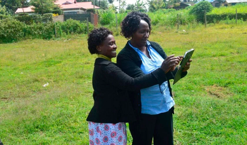
Importantly, the project supported women and community leaders to take stock and record all the public land in their areas of residence. A select group was then nominated to undergo a technical training on the GIS using GPS and tablets to record. Their role was then to visit each and every piece of public land mapped and take all the coordinates. The information was finally transferred using Arc GIS software to create a digital map of this record.
Through this initiative, communities realized their role to protect illegal and irregular allocation of public land. This is evi-dent from the actions they have taken since to safeguard public land. Moreover, government and land experts appreciate the role and capacity of women who in turn are invited and recognized as leaders in their own rights. Last but not least, planners and decision makers have used the developed map to plan and budget effectively for development initiatives.